Photo monitoring
We’ve all seen the changes that happen along our coast – some more extreme than others. This was Cottesloe Beach after storms in 1927. (Photo from The Grove.)
Frauke recently went on a tour with the Northern Agricultural Catchments Council and saw how others are using photo monitoring to record the processes that are potentially damaging to our coast. She visited some of the sites where photo monitoring is happening including Grigson’s Lookout near Jurien Bay, Thirsty Point and Seabird.
She also heard about a way of propagating Nitraria billardierei that has been successful in Jurien Bay – apparently collecting it after it has passed through the digestive tract of a seagull works!

Cottesloe Beach after storms in 1927. Photo from The Grove.
More information about photo monitoring can be found here:
- How to Photo Monitor Beaches from the Department of Transport.
- Community photo-monitoring from the Northern Agricultural Catchments Council.
This reminded me that although we don’t have a formal photo monitoring project in Cottesloe we are lucky to have a good collection of pictures (mostly from Robyn) which give us some idea of the changes that happen on our bit of the coast and you can see some of them here….
Mudurup Rocks
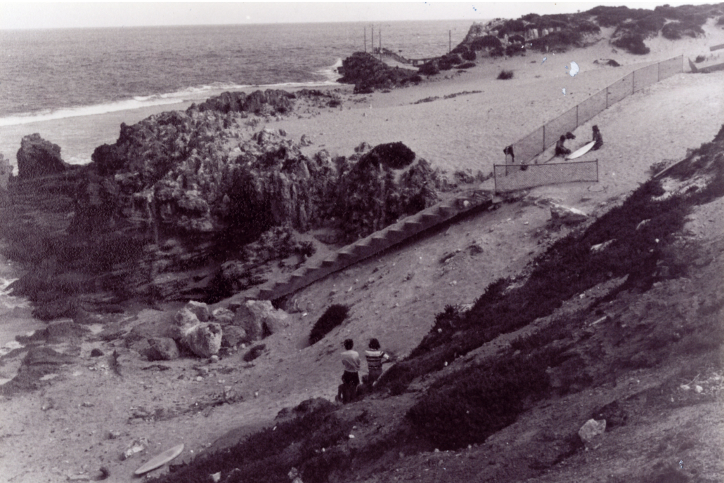
Mudurup Rocks in the 1970s
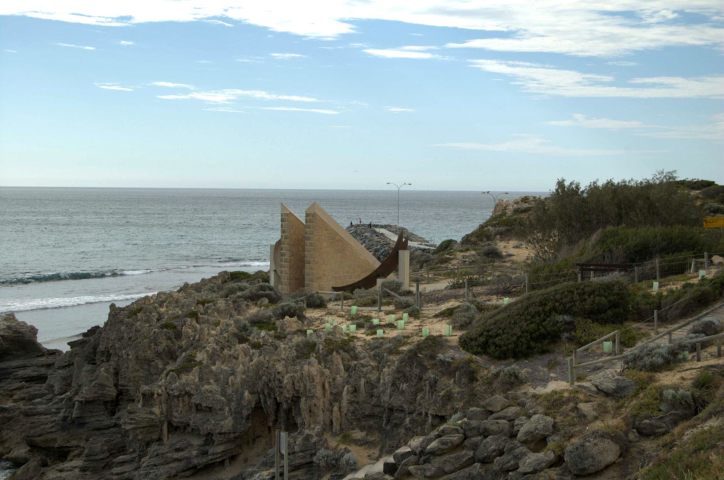
Mudurup Rocks in 2006
Grant Marine Park
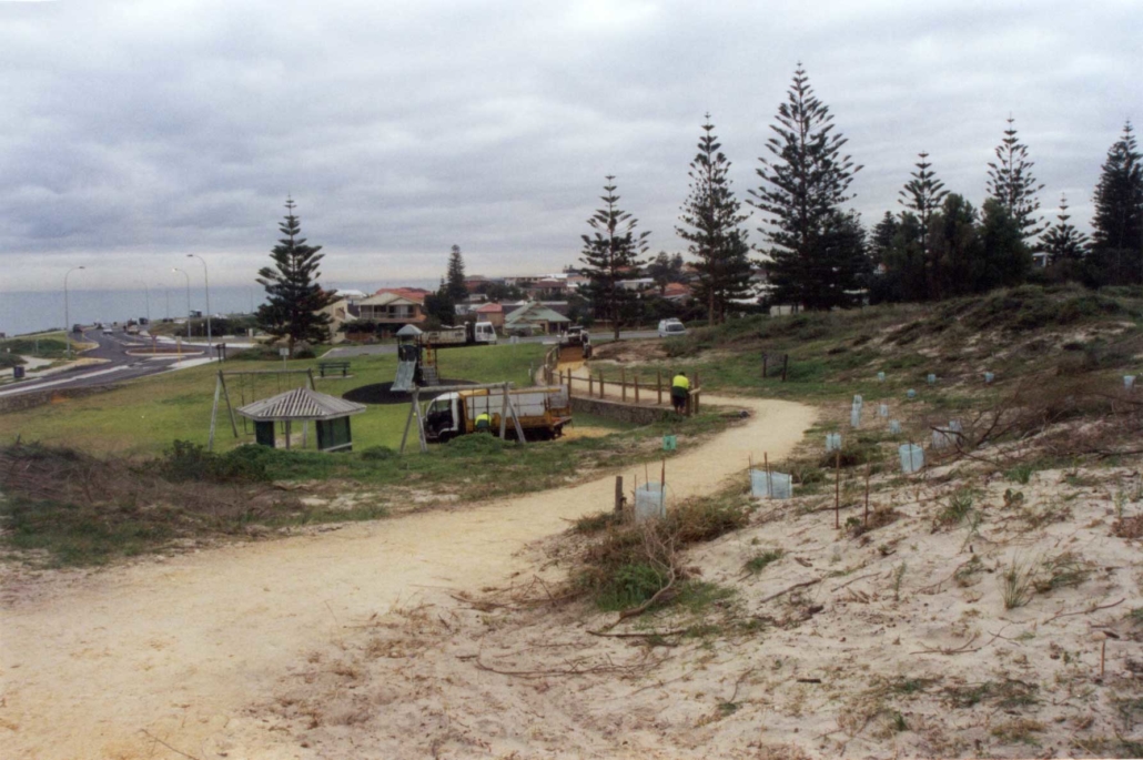
Grant Marine Park in 2003
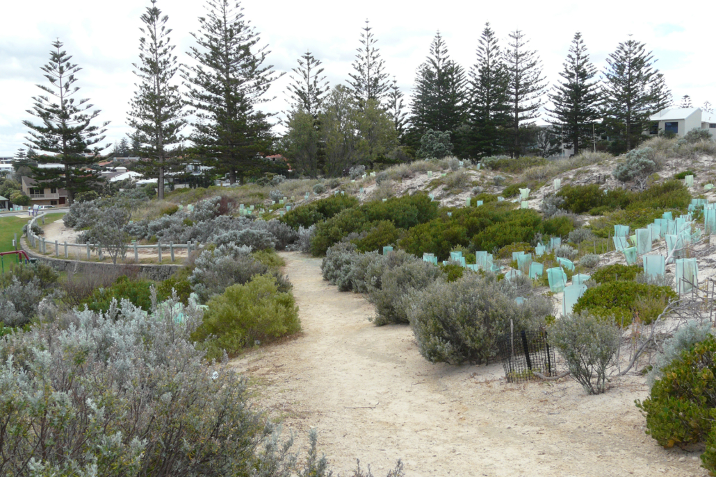
Grant Marine Park in 2011

